Smart Digital - Advanced Infrastructure Monitoring
Revolutionizing Critical Infrastructure Management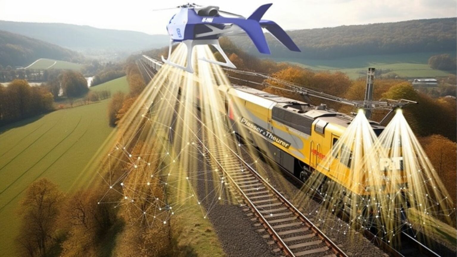
Comprehensive Infrastructure Digitization
Smart Digital leverages cutting-edge technology to transform the monitoring and management of critical infrastructure across railway, energy, and roadway sectors.
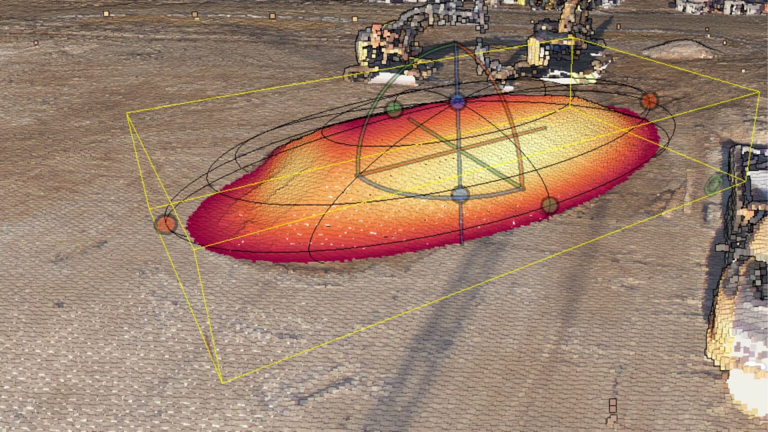
Object & Terrain Visualization
In the planning phase of new infrastructure paths, SmartDigital conducts in-depth terrain assessments:
- Precise surveying of planned areas and determination of required distances
- Automated checks for potential threats like vegetation or at-risk trees
- Effective management of construction sites
- Digital twin representation of construction progression
- Precise measurement of construction debris and materials for accurate billing
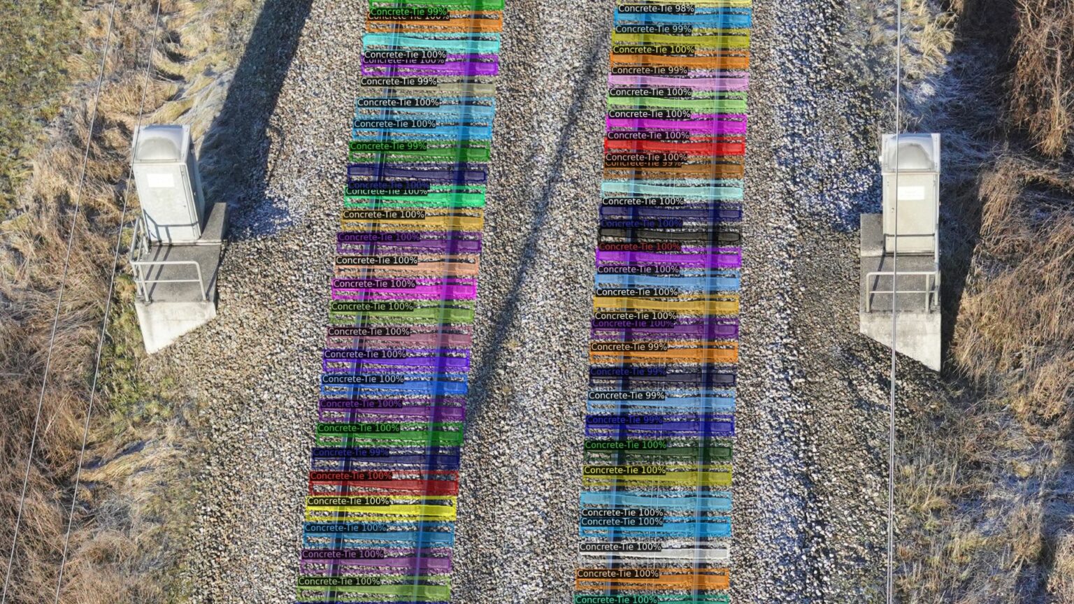
Object Recognition & Inventory
SmartDigital enables consistent digital cataloging of crucial infrastructure:
- Recognition of objects along planned or existing pathways (poles, insulators, ties, switches, etc.)
- Identification and mapping of safety structures (avalanche barriers, rockfall nets, etc.)
- Automatic detection and listing of components with geographical coordinates
- Utilization of aerial data gathering methods (video, infrared, laser)
- AI-driven processing and analysis for digital archiving and categorization
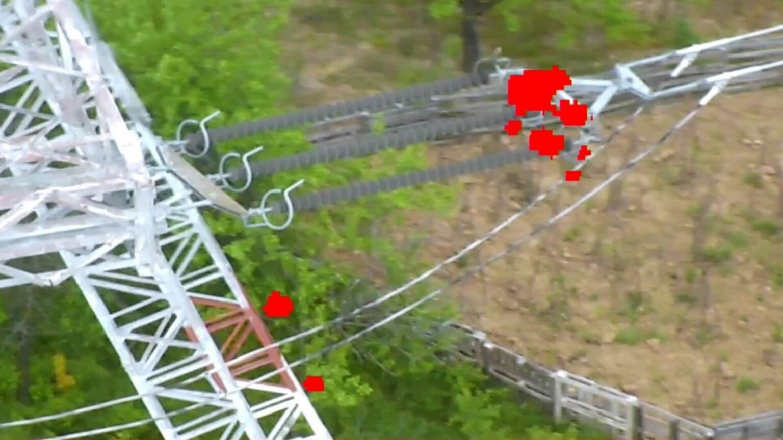
Condition Monitoring
Advanced AI-powered monitoring system for infrastructure maintenance:
- AI-powered image analysis for object identification and comparison
- IoT system for prompt alerting and forwarding of concern areas
- AI-backed vegetation monitoring, especially for tree-fall perimeters
- Unmanned aerial systems (UAS) for forward-thinking maintenance
- Swift identification of potential threats (building fractures, landslides, etc.)
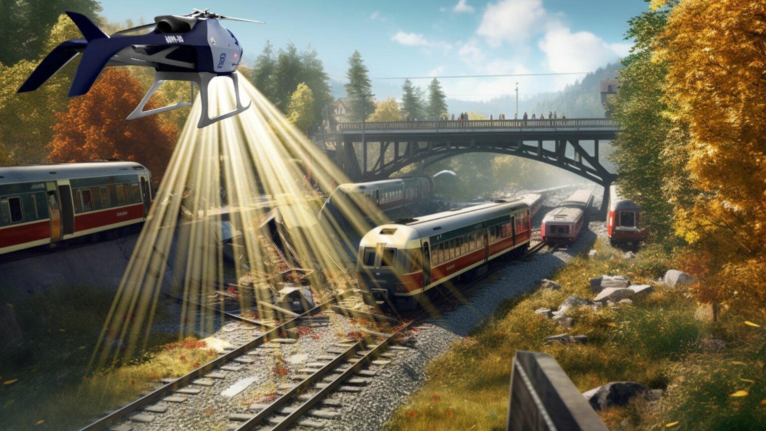
Incident Recognition and Emergency Exploration
Drone technology for critical infrastructure emergency management:
- Swift situation assessment through UAS visual checks and data gathering
- Enhanced speed and efficacy of decision-making during emergencies
- Rapid damage assessments after storms or natural disasters
- Real-time flight monitoring with "live views" integration
- Capability for instant response, even during nighttime operations